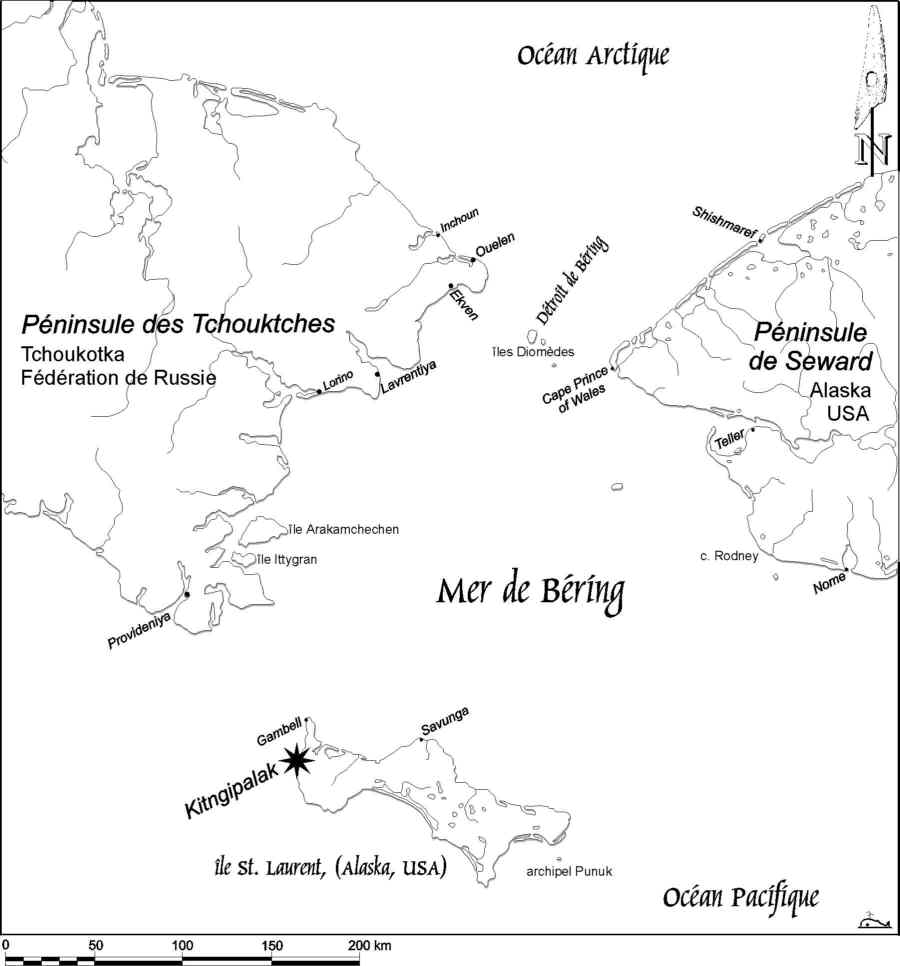
Fig.
1 - Carte de la mer de Béring, illustrant la position de l'île St. Laurent par
rapport à la péninsule des Tchouktches (Tchoukotka, Fédération de Russie) et
par rapport à la péninsule de Seward (Alaska, Etats-Unis d'Amérique).
Copyright 2000 by Blumer Reto.
Copyright 1997 by University of Geneva, Faculty of Sciences, Department for
Anthropology and Ecology, Geneva, Switzerland.
For problems or questions regarding this web contact rblumer@vtx.ch